Discovering hidden hydrocarbons: using seismic-imaging technology to map formations far below the earth's surface
In this article
Since those early experiments, ExxonMobil has been a leader in the development and application of technologies necessary to acquire, process and interpret 3-D seismic data.
Seismic data collection
ExxonMobil actively develops technologies and applies global experience to improve the quality of collected seismic data in the field with minimal impact to surroundings. Recent advancements allow for the acquisition of broader frequencies of sound waves, providing our geoscientists and engineers with more information about subsurface properties. In addition, ExxonMobil has recently expanded its novel application of onshore multiple simultaneous seismic sources methods to offshore settings, reducing the time, cost and environmental impact of data acquisition.
Advanced imaging
Our proprietary and patented algorithms, coupled with investments in supercomputers accomplish the massive computational task of analyzing seismic data while making it available to the ExxonMobil teams that manage exploration, development and production assets in time to make the most effective business decisions. Our proprietary 3-D velocity modeling software enables data interpreters to construct detailed models, enhancing our ability to accurately visualize complex subsurface structures. In addition, recent advances in full wavefield inversion are equipping us with more accurate subsurface information than previously available.
Full Wavefield Inversion (FWI)
Full wavefield inversion (FWI) is an integral part of our exploration and development efforts and a signature part of our suite of seismic capabilities known as EMprise. Combined with supercomputing technology, FWI provides our geoscientists with unparalleled insights into subsurface geologic structures and the physical characteristics of rocks.
In the past, the industry could only utilize a portion of the data recorded in 3-D seismic surveys due to the high complexity of the seismic waves and the sheer quantity of data. Now, FWI has provided us the ability to better leverage all of the data from a seismic survey to produce high-definition images of the subsurface. Specifically, FWI enables us to more accurately map geologic structures and determine with more certainty whether or not the rock may contain hydrocarbons. In doing so, we can help make oil and gas resources easier to identify and target in exploration, development and production programs. For fields where ExxonMobil is currently producing oil and gas, FWI is applied to time-lapse, or 4-D seismic surveys, to help map out remaining hydrocarbons. These capabilities can make resource development and production more efficient, less costly and more environmentally friendly through optimized drilling.

The full wavefield inversion process begins with a geologic model of the subsurface rock properties. Computer-generated synthetic seismic data derived from the model is then compared to the real-world field seismic data. The differences between the two are used to update the model to more accurately reflect reality. This process is repeated until there is a match between the synthetic and real data. The simulation needs to incorporate a high degree of realism, correctly representing the seismic acquisition geometry and the physics governing seismic wave propagation in the subsurface.
The FWI approach is a significant departure from the way seismic data are currently used to image the subsurface. Standard seismic analysis is time- and labor-intensive, consisting of a series of operations designed to remove noise and unwanted signals from the data prior to imaging. After imaging, subsurface properties are estimated, but there is no explicit feedback loop to compare these estimates with the original field data. In contrast, the FWI process is largely automated using computer simulation to bypass the time-consuming steps of the traditional approach.
ExxonMobil’s proprietary algorithms and investments in supercomputers allow us to increase the range of frequencies used by full wavefield inversion so we can create remarkably precise maps of subsurface structures. In most published FWI studies, only the lowest frequency portion (less than 10 Hz) of data using simple simulation physics is inverted, resulting in low-resolution models. At ExxonMobil, we have run FWI on 3-D seismic surveys using higher frequencies and more simulation physics, generating high-resolution and more accurate models of the subsurface.
The improved imaging and reservoir characterization provided by FWI has quickly translated to improved results in the field. For example, high-resolution seismic images and models derived from our FWI technology were used to optimally target drilling and form an integral part of our ongoing activities in Guyana.
Full wavefield inversion remains an active area of research at ExxonMobil. Advancements in computing and algorithms remain necessary as we use more complex simulation physics and push the resolution limits of seismic data. Our investments in high-performance computing and in full wavefield inversion technology have allowed us to be an industry leader in seismic imaging.
Predicting subsurface characteristics
ExxonMobil is also using seismic technology in innovative ways to better understand hydrocarbon reservoirs. One of many examples is our ability to use seismic data to predict the distribution of natural fractures, which are important pathways for oil and gas flow in tight reservoirs. By analyzing how sound waves bounce off subsurface rock structures, we can predict the intensity and orientation of fractures. These predictions help identify areas of enhanced flow and optimize well placement, translating to fewer wells and more efficient drilling.
4-D seismic imaging
In reservoirs that are under production, we can track changes that occur in subsurface reservoirs by repeating 3-D surveys over time to create a time-lapse or 4-D seismic image. The interpretation of 4-D seismic data helps ensure optimum oil and gas recovery from our existing fields.
During production, changes in reservoir pressure, temperature and fluid saturation can cause changes in the physical properties of the reservoir rocks themselves.
Time-lapse seismic technologies developed and applied by ExxonMobil, including 4-D full wavefield inversion, result in high-definition images of seismic changes that enable us to interpret changes in a reservoir with more certainty. Integrated with conventional field-production data and reservoir models, 4-D seismic methods help increase the productivity of ExxonMobil’s production assets as a result of the improved decision-making derived from the data.

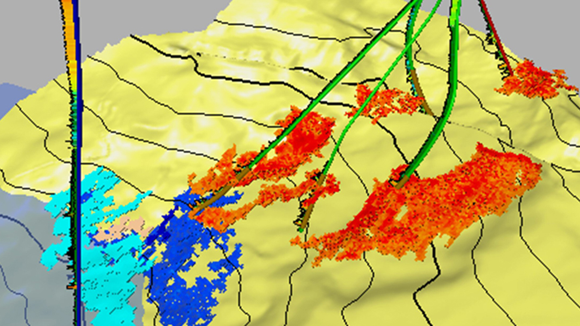
ExxonMobil has applied 4-D seismic technology over a wide range of geographical areas, geological settings and production scenarios — from monitoring water and gas sweep (see image) in our deepwater Angola production wells to the thermal recovery processes used at the Cold Lake heavy oil field in Alberta, Canada. Our experience has demonstrated that 4-D seismic methods can improve our understanding of the reservoir by identifying its distinct compartments and mapping the most permeable fluid flow pathways. The data can be used to locate unproduced oil and gas, increasing the efficiency of existing wells and reducing the need for additional wells and drilling.
Related content
